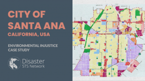
Project: Environmental Injustice in Santa Ana, California, USA
This project creates space for collaborative work to characterize and address enviornmental injustice in the City of Santa Ana in Southern California.
Image

AQUEDUCT Water Risk Atlas
Provides lobal water availability risk data (including water stress and flood hazards).
ICES Data Portal
International Council for the Exploration of the Sea data on fishing, coastal habitats, and ocean water quality.
SEA AROUND US FISHERY DATA
Fishery activity data available by taxon and country.
International Council for the Exploration of the Sea Data Portal
Detailed ocean and fishery data.
Notre Dame Readiness Score
This website shows Urban Indicators and gives each indicator a score. These indicators for risk include sensitivity, adaptive capacity, and exposure.

Orange County Launches OC Equity Map
The flyer is made to educate others about the new OC Equity Map created by Orange County.

Google map view of BrassTech Inc.